North-bound travelers on the Malahat will get a new introduction to the Cowichan region as of June 15.
Information, directions and incentive to explore the region has been updated and linked electronically with the installation of new signage at the Malahat Viewpoint rest area.
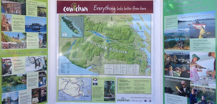
A large scale map provides the viewer with an overview of the Cowichan region, and symbols indicate the location of activities and attractions. Colorful and engaging photographs tell Cowichan’s story and entice the viewer to take part in the experiences depicted on the sign.
Each community – including Ladysmith and Chemainus – is showcased in photos, with its key attributes highlighted. Information about the Pacific Marine Circle Route is also included.
“Visitor Centre locations, a QR code directed to the Tourism Cowichan website and strong calls to action will encourage visitors to seek out more information about what they are viewing on the sign,” says a release from Tourism Cowichan.
Installation of the new sign, which replaces a derelict structure that had been in place since 1986, is part of an overall upgrade of the rest area.
The City of Duncan will be refurbishing the totem pole at the viewpoint, and erecting interpretive signage about the totem route. A joint unveiling is being planned for early fall.
Northbound traffic on the Trans Canada averages 11,000 vehicles a day during summer months, and the viewpoint rest area is used extensively by tourists, Vancouver Island residents and locals.