The BC Wildfire Service Twitter account posted a cautiously optimistic tweet about the amount of rainfall across the province.
“Fire activity remains low across BC due to cool conditions and rainfall. This may feel like a stark contrast compared to what was experienced in 2017,” the tweet reads.
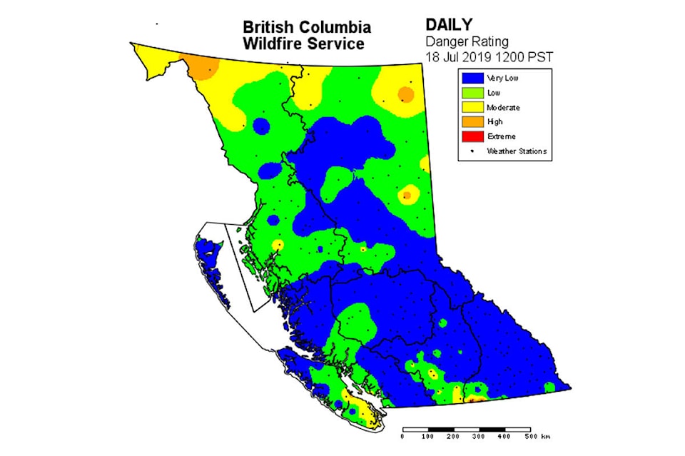
Three images of B.C. maps were attached to the tweet. The maps depict the province’s danger rating in the years 2017, 2018 and 2019. The maps from 2017 and 2018 show large areas covered in yellow, orange and red, signifying moderate, high and extreme risk of wildfires. The most recent map, however, shows most of the province covered in blue and green, representing low to very low risk of fires.
Even still, the BC Wildfire Service maintains this is no reason to become complacent and asks British Columbians to take all precautions to prevent wildfires.
Fire activity remains low across BC due to cool conditions and rainfall. This may feel like a stark contrast compared to what was experienced in 2017 & 2018, however it is no reason to become complacent. Please continue to take all precautions to prevent human-caused #BCwildfire. pic.twitter.com/gwZYnacFWe
— BC Wildfire Service (@BCGovFireInfo) July 19, 2019
Read more: UBC Okanagan professor details wildfire risks
Read more: Water bombers arrive to douse spot fire off Highway 33
@CameronJHT
Cameron.thomson@saobserver.net
Like us on Facebook and follow us on Twitter.